[Science to the Future]
editorial comment/note
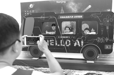
In daily life, people always like to ask three questions: when, where are you and what are you doing. More than 90% activity information of human society is related to time and space. Now, spatio-temporal information service has penetrated into all fields of human production and life, and it is as indispensable as water and electricity. It was learned from the 2017 China Geographic Information Industry Conference that with the development of Beidou satellite system in China, China has mastered autonomous, independent and controllable satellite navigation technology, greatly improved its spatio-temporal information service capability, and obtained technical support for new formats such as bike-sharing and driverless. Then, in the era of artificial intelligence, what subversive innovations and surprises will happen in the field of spatio-temporal information services? This edition of Science invited Liu Jingnan, an academician of China Academy of Engineering, Li Deren, an academician of China Academy of Engineering, and Guo Renzhong, an academician of China Academy of Engineering, to explain in detail.
Liu Jingnan (Academician of China Academy of Engineering):
From Spatio-temporal Information to Big Data Service
The great challenges and opportunities brought by artificial intelligence to various industries are unprecedented, which will cause industrial changes in the next at least 50 years. The innovation and development of geographic information industry must change the way of thinking, establish the thinking of Internet of Things, big data and time and space, serve the society through cross-border integration, strive for the initiative in the intelligent era, and realize the overall transformation of green and intelligence.
As a producer of massive spatio-temporal data, the geographic information industry may be completed by machines in the intelligent era from data collection to data application in all walks of life. For example, with the increasing intelligence, real-time performance and reliability of the precision of intelligent sensor equipment and measuring equipment, the work that needs to be done by people before, even risking their lives, will be done by intelligent equipment and robots. This means that some data collectors in the geographic information industry will probably be replaced by robots.
So, does this mean that the geographic information industry is going to decline? The answer is: no!
With the progress of science, human demand for space-time services is moving towards real-time and instant, from static to dynamic and high-speed, from rough to accurate and complete, from land to sea and sky, from region to global, from earth to deep space and universe. The existence demand of geographic information determines that it will not disappear in the era of intelligence, but it must complete the transformation from informationization to intelligence.
Human beings are increasingly demanding the quality of location services, and the geographic information industry must improve the service quality, including monitoring the environment, human health, personal safety, spatio-temporal dynamics and other aspects more accurately, so as to meet the ever-changing personalized, intelligent, real-time and accurate service requirements in the "internet plus" and intelligent era.
In this sense, the geographic information industry will not gradually decline under the impact of the wave of intelligent revolution. The advantages of China geographic information industry in the whole wave of intelligent revolution are: first, the world’s largest demand market for location services and huge space-time location information, which can provide rich data resources for intelligence; Second, the geographic information industry has the right to interpret the spatio-temporal position datum, and the right to formulate the standards of accuracy, characteristics and complexity of spatio-temporal position data.
How to help the industry transform? How to meet the different service demands in the era of "internet plus"? How to maximize the potential value of big data through artificial intelligence? In the era of intelligence, the geographic information industry should make use of its own advantages, seize the increasingly high demand for time and space location services in the information age, and realize cross-border integration. For example, a "geographic information brain" can be established by using spatio-temporal data clouds. This "brain" needs to have the abilities of perception, memory and thinking, learning, self-adaptation, and behavior decision-making, and complete the prediction ability through intelligence.
How to fully explore and understand the massive big data and unify the spatio-temporal big data with different categories, different precisions and different dimensions into the standard system of data service is a big challenge in the intelligent era. In addition, talents who can transform artificial intelligence knowledge into commercial application value are also in short supply and need to be cultivated urgently. The change of thinking and the influence of independent decision-making brought by the intelligent era are the biggest challenges to the industry and individuals.
Li Deren (Academician of China Academy of Sciences, Academician of China Academy of Engineering):
Ideas of Earth Observation Brain, Smart City Brain and Smart Phone Brain
Now, China has a lot of spatial data. There are satellites in the sky, drones in the air, intelligent driving cars on the ground, video cameras and various sensors, plus people’s mobile phones and smart watches, which generate hundreds of millions of data all the time. Through technological innovation, China’s satellite navigation technology is becoming popular and intelligent, and spatio-temporal information big data and spatio-temporal information cloud platform are being built everywhere.
This is the current state of spatial big data, but at present, China’s remote sensing, navigation and communication systems are isolated, information is separated, and space-time services are relatively backward, so we need to improve. Now it is necessary to integrate isolated systems through "multi-network". If spatial big data is to serve well, it must be activated by artificial intelligence.
Artificial intelligence involves brain science. The origin of artificial intelligence is a kind of progress in brain science, and the whole world is competing to study it. The United States and Europe have started brain science programs. In recent years, China also attaches great importance to the development and construction of brain cognitive science, and proposes that by 2030, the theory and technology application of artificial intelligence will reach the world’s leading level.
Perception, cognition and action is a basic function of human brain, and computers do not have this function. However, if people’s perception, cognition and action are integrated, and spatial big data is combined with artificial intelligence, many "smart brains" can be formed. The author conceived three "wisdom brains", such as:
First, "Earth observation brain": Earth observation brain is analogous to human brain, which has visual and auditory functions and obtains information through visual and auditory functions. Earth observation brain transmits satellite data in the sky to the ground to meet people’s requirements through big data and cloud computing. This brain is an automatic recognition system of brain cognition and perception, which completes the cognition and processing of data through remote sensing communication of satellites in the sky.
The key problem to be solved in earth observation brain is to provide services on demand. It is necessary to break through major key technologies such as satellite-based navigation enhancement technology, integrated network communication technology between heaven and earth, multi-source imaging data on-orbit processing technology, space-based information intelligent terminal service technology, space-based resource scheduling and network security, integrated nonlinear earth reference frame construction technology, and load-based satellite platform design and development technology.
Second, the operation center of a smart city should be made into a "smart city brain". Smart cities have sensor networks and cloud computing. They are the "cloud brains" of smart cities that feel the interaction between people and cars in real time. Using big data to improve the operation and management level of cities and engaging in big data value-added services can provide real-time services for all walks of life. It can be supported by geographic information system, which is based on real-time data to analyze feelings. It is necessary to gain insight into data management and realize smart cities on the cloud. Such management can improve the level of smart cities, and the operation center of smart cities should be made into the brain of smart cities.
Third, there must be a large number of sensors to make the mobile phone a "smart phone brain" to help the owner. In the evolution of smart phones, human behavior can be inferred from the data in the phone, which can understand the owner’s behavior and psychology and remind people what to do and what not to do. Using big data system for reasoning, the mobile phone knows whether the owner is walking or surfing the Internet at home. Through data analysis and reasoning, a conclusion is drawn in the mobile phone. For example, if the owner falls in the snow for 5 minutes, he can automatically dial 110 or notify his family to save him. Such a mobile phone is a real smart phone.
There are many applications of artificial intelligence in geographic information industry. For example, automatic change detection and real-time processing of UAV high score data. The innovation of sensors should develop in the direction of artificial intelligence and brain intelligence, similar to earth observation brain, smart city brain and smart phone brain. Only by grasping these frontiers can geographic information industry become a big industry needed by all mankind. Spatio-temporal geographic information used to be static, but now it must move towards a new stage of intelligence.
Guo Renzhong (Academician of China Academy of Engineering):
Big data will make urban management smarter.
The arrival of the era of big data and artificial intelligence makes people look forward to the geographic information industry.
At present, there are not only data uploaded by mobile Internet, but also data of space remote sensing. When the amount of data is large, it will be found that the value of data is not positively related to the amount of data, which makes people think, how can data generate value? Spatio-temporal information, if using big data and developing towards artificial intelligence, will have great application space. Many emerging industries need spatio-temporal information to support them, such as bike-sharing. China’s geographic information industry is still in the "farming era". If the data link is further extended, the added value of data may increase a lot. For example, many places are now building smart cities, which need a lot of geographic information data to support them. From this perspective, the spatio-temporal information service should not only be satisfied with providing very beautiful and accurate traditional data, but also provide data that is more in line with the terminal and meets the needs of users.
For example, the national geographic information survey has spent a lot of manpower and material resources, which can not only provide image records, but also provide a lot of value-added services. However, this value-added service is different from the professional technology possessed by traditional geographic information practitioners, and the business and products have to cross borders to have greater value, which cannot be satisfied with providing original data and products. In the process of cross-border, big data plays an important role and needs to be combined with artificial intelligence to find a better service path.
What is the use of spatio-temporal data information in smart cities? For example, make a distribution analysis of the resident population and the employed population in Shenzhen. A person has two most frequent places — — Home address and workplace. From home to work in the morning, and from work to home in the evening, he has to go through the relevant traffic network. In this way, he can know the traffic flow and traffic pressure of different road networks by means of big data, thus doing bus route optimization and road planning optimization for this traffic network. Big data will make urban management smarter.
Now, a lot of geographic information data still exists in the databases of relevant departments, so it is necessary to turn them into "clouds" to realize socialized sharing and socialized services. When it becomes a "cloud", it should not only be able to dynamically update and fully perceive, but also be able to quickly access the Internet for easy use; At the same time, we should be able to deeply integrate geographic information with other information of the city to form a socialized urban information, and then carry out relevant deep mining and application on this basis to promote urban management to be intelligent.
关于作者